Travel - General & Miscellaneous, European Atlases & Maps, Atlases & Maps, Great Britain & Ireland - Travel, Travel Interests
Log in to track your reading progress.
Overview
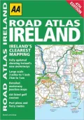
Ireland's clearest mapping, from the experts at AA
Updated from Ireland's Official Mapping Agencies, OSI (Ordnance Survey Ireland) and OSNI (Ordnance Survey of Northern Ireland), this atlas includes AA approved camping sites and AA recommended golf courses, car parks, picnic sites, port plans, and ferry routes. There are motorway strip maps detailing all of Ireland's motorway junctions; 11 detailed city and town plans—Belfast, Cork, Londonderry, Dublin, Galway, Killarney, Kilkenny, Limerick, Sligo, and Waterford; and an easy-to-read 3,500 place name index, including tourist sites.
Book Details
Published
June 13, 2026
Publisher
AA Publishing
Pages
96
Format
Paperback
ISBN
9780749565398