Canada - General & Miscellaneous - Travel, Canada Atlases & Maps, Outdoor & Adventure Travel
Log in to track your reading progress.
Synopsis
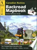
This backroad mapbook is a complete road and recreation atlas for the Canadian Rockies. It includes over 50-colour recreational GPS-compatible relief maps and information on outdoor recreational opportunities available in the area. The book covers four national parks (Banff, Jasper, Kootenay, and Yoho), six provincial parks (Elk Lakes, Hamber, Height-of-the-Rockies, Mount Assiniboine, Mount Robson, and Wilmore Wilderness), and detailed maps of cities and towns in the area.
Book Details
Published
June 18, 2026
Publisher
Mussio Ventures
Pages
144
Format
Spiral
ISBN
9781894556989