U.S. Atlases & Maps, Children - Nature, U.S. Travel - General & Regional, General Reference, Children - Games & Activities
Log in to track your reading progress.
Overview
"Taking a playful approach to geography, Clouse presents a map of the U.S., then separates the shapes of individual states and combines them in new ways. Children will play along for the fun of it." --Booklist
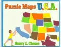
Introduces the fifty states and their shapes, showing the states in various configurations aside from their normal arrangement.
Editorials
From the Publisher
"Taking a playful approach to geography, Clouse presents a map of the U.S., then separates the shapes of individual states and combines them in new ways. Children will play along for the fun of it." --Booklist
Publishers Weekly -
Clouse has some colorful fun with a map of the U.S., and encourages children to do the same. First she reveals a double-page spread of the map, with each state labeled. On the next page, each state is a different color, the names have been omitted and the map has become a large puzzle that can be taken apart visually and put back together. With the shapes of the states as pieces, a variety of ``picture puzzles'' follows, each depicting persons or objects that include a wagon, a turtle, a man walking a dog, a carousel horse and a clown. Under each composite picture, the names of the states that comprise the image are printed upside-down, while at the end of the book a more detailed ``puzzle key'' shows readers--in line drawings--which state was used to make each part of the picture. Clouse succeeds in enlivening a potentially dull subject in this unusual book. Ages 7-11. (May)School Library Journal
Gr 2-4-- A refreshing approach to map skills. The book provides a very basic introduction, covering the concepts of shape and proportion (i.e., a map may be large or small causing the size of the state to change, but its shape remains unaltered). There is no mention of scale or direction. The emphasis is on puzzle activities that utilize the different shapes of the states. Children are asked to identify the states that make up a turtle, a tree, and other familiar objects. The pleasing use of basic colors and the effective layouts with collage figures make the book more visually appealing than many map books. The puzzles, however, are apt to be difficult because some of the states are shown at different angles, and they do not remain the same color throughout the book. Also, some states such as Colorado and Wyoming are identical in shape. In order to identify states, readers must continually flip back to the front map pages. Answers are provided on each page, with more detailed keys at the back of the book. Despite these limitations, the book offers some enjoyable exercises, and the U. S. geographic trivia at the end of the book can be used to initiate more activities. It is this approach to playful learning that makes the book a success. --Lori A. Janick, Parkwood Elementary School, Pasadena, TXBook Details
Published
September 1, 1994
Publisher
Henry Holth & Co (J)
Pages
32
Format
Paperback
ISBN
9780805035971