Europe - General & Miscellaneous - Travel, General European Atlases & Maps
Log in to track your reading progress.
Overview
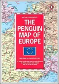
Newly revised to incorporate boundary changes in Germany, the former USSR and YugoslaviaCovers all lands eastward to the Urals, southward to North Africa (including parts of Morocco, Algeria and Tunisia) and south-eastward to Syria, Iraq and Iran
Scale - 1:5,500,000
Legend in English, German and French
Featuring main roads, railways, principal oil and gas pipelines (including North Sea)
Extra information includes new and existing national flags, international number plates and details of populations and currencies.
This four-color political map shows main roads and railways, principal oil and gas pipelines as well as the locations of more than 6,300 municipalities.
Book Details
Published
January 1, 1920
Publisher
Penguin Books Ltd
Pages
1
Format
Paperback
ISBN
9780140512861